

Meridian M27LV GNSS RTK Receiver with Laser, Cameras, 4G and IMU


Meridian M27LV GNSS RTK Receiver with Laser, Cameras, 4G and IMU
- Online Payment
- Payment by Invoice
- Bank Transfer
- Air Mail Delivery
- Delivery via DPD
- Delivery via DHL
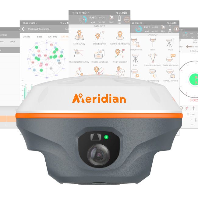
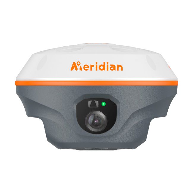
Meridian M27LV is a versatile GNSS RTK surveying receiver for topographic surveys, cadastral and construction applications, stakeout, and the measurement of hard-to-reach objects.
By combining satellite positioning, a laser rangefinder, two cameras, and IMU tilt compensation, it lets you choose the most practical measurement method for each task. You can survey with an upright or tilted pole, measure individual points with the laser, or determine their coordinates from photographs.
Package Contents:
- Meridian M27LV GNSS Receiver
- Permanent M-Survey license for Android
- USB-C Cable
- Power Adapter
- UHF Antenna
- Warranty Card
- Carrying Bag
Laser Measurement of Hard-to-Reach Points
The built-in laser rangefinder allows you to obtain the coordinates of visible points without placing the survey pole directly on them. This is useful for measuring building corners behind fences, facade features, points on slopes, and objects in areas where access is restricted or hazardous.
To determine the target point’s coordinates, the receiver combines its own RTK position, its spatial orientation, and the distance measured by the laser.
Camera-assisted targeting helps you select the required point and check where you are aiming on the controller screen. This is particularly useful when the laser spot is difficult to see.
Two Cameras for Different Tasks
The Meridian M27LV’s cameras extend its field capabilities in two ways:
- Visual stakeout with augmented reality (AR). A live view of the site is overlaid with guidance to help you navigate to the design point.
- Photogrammetric measurements. Images captured from different positions are used to determine the coordinates of individual features on an object.
Photogrammetry: Capture Images First, Measure from Them Later
The Meridian M27LV supports image capture for photogrammetric measurements. The operator photographs an object from different positions, and the resulting images are then used to determine the coordinates of the required points.
This approach is useful when you need to measure several features on the same object, such as building corners, door and window openings, or other clearly visible facade details. Instead of targeting each point individually, you can capture the images first and then work with them in the appropriate software.
AR Stakeout: Visual Guidance Overlaid on the Site View
During stakeout, the camera helps you relate the design to the actual surroundings. The controller screen displays a live view of the site with navigation guidance overlaid on it.
This makes locating points more intuitive and helps you get your bearings faster. Final positioning is checked using the software’s numerical accuracy indicators and offsets from the target point.
IMU: Surveying with a Tilted Pole
The inertial measurement unit (IMU) determines the receiver’s tilt and orientation, allowing the software to calculate the coordinates of the pole tip while accounting for the pole’s position.
Tilt compensation reduces the need to hold the pole perfectly vertical for every measurement. This makes surveying near walls, fences, and other obstacles easier and speeds up the collection of large numbers of points.
Connectivity for Different Working Conditions
The receiver provides connectivity for receiving RTK corrections and communicating with a field controller. The built-in cellular modem allows you to receive corrections over a mobile network, while the internal radio modem enables operation with your own base station.
Radio communication is useful on sites without mobile coverage. Actual communication range depends on terrain, obstacles, antennas, and equipment settings.
Control Through M-Survey
The Meridian M27LV is operated using Meridian’s dedicated M-Survey software.
The software provides tools for equipment configuration, RTK surveying, stakeout, and access to the receiver’s supported features. Integration with the hardware allows you to work with the laser, cameras, and IMU in a single field software environment.
Meridian M27LV Applications
- Topographic and cadastral surveys.
- Construction surveying.
- Stakeout of design points.
- Surveying buildings, structures, and infrastructure.
- Measuring visible points with difficult or restricted access.
- Determining the coordinates of object features from photogrammetric images.
The Meridian M27LV combines several measurement methods in one receiver, helping you complete more field tasks without repeatedly switching equipment.
-
Dimensions (mm):125 x 125 x 79
-
Weight (kg):0.75
-
Manufacturer country:China
-
Number of channels:1408
-
Positioning horizontal accuracy:8 mm + 1 ppm
-
Positioning vertical accuracy:15 mm + 1 ppm
-
Sattelite systems:GPS: L1 C/A, L2C, L2P, L5; GLONASS: L1 C/A, L1P, L2 C/A, L2P; Galileo: E1, E5a, E5b, AltBOC; BeiDou: B1, B2, B3; BeiDou Global Signal: B1C, B2a; QZSS: L1C, L2, L5, L1C/A; IRNSS1; SBAS: WAAS, EGNOS, MSAS, GAGAN
-
Frequency:1-10 Hz
-
Bluetooth:5.0
-
Integrated memory:32 Gb
-
Communication standard support:2G/3G/4G/WiFi
-
Ingress Protection:IP68
-
Battery life:up to 22 hours
-
Tilt Compensation IMU:Yes
-
Warranty:2 years
-
Laser:Yes
-
Laser range, m:50